FEMA Elevation Certificate Tips Near Flood-Prone Lots
A FEMA elevation certificate ties a building’s height to the flood data that FEMA has mapped for its area. For homes on low or flood-prone ground, that link can shape some big decisions. Owners lean on it when they deal with flood insurance, loans, permits or questions about how risky a spot really is.
This form does much more than list a few numbers. It places one structure inside the official flood picture drawn for the wider area. Agencies, lenders and insurers all use that connection to weigh how a property might handle rising water.
Understanding Flood Maps Before Requesting a FEMA Elevation Certificate
FEMA creates flood maps that sort areas into different flood zones. These maps, called Flood Insurance Rate Maps, may also list a Base Flood Elevation for certain spots. That number marks how high water could rise during a serious flood.
Before ordering the certificate, it helps to look up your own map details. The panel number, the flood zone and the exact location all shape what the survey will need to show. When you know these facts early, the professional has a clear target from the very start.
Property Features That Can Affect Elevation Documentation
Not every building is measured the same way. The type of foundation makes a big difference, whether the home sits on a slab, a crawlspace or a basement. An attached garage or a set of flood openings can change the readings too.
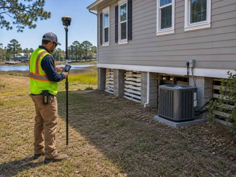
The location of machines like air conditioners or water heaters also matters. So does the lowest floor that people actually use day to day. The surveyor records each of these parts by following the rules on the FEMA form, so the finished document reads correctly for everyone who checks it.
Common Reasons Insurers or Lenders Request Updated Information
Sometimes an older certificate is no longer enough. An insurer or lender may ask for fresh information when the current paper is missing details or looks out of date. A change to the building can trigger the same request.
New flood maps are another common reason. When FEMA updates the map for an area, the older readings may not match the current data. Each insurer and lender can set its own rules, so requests can differ quite a bit from one to the next.
Preparing Your Property Before the Survey Visit
A smooth visit depends on clear access. The surveyor has to reach every side of the building, along with spots like crawlspace openings and utility areas. Moving stored items and unlocking gates before the visit keeps the measuring on schedule.
Some paperwork rounds out the prep. Older certificates, permits and any flood map notes give the surveyor a useful base to work from. Handing these over at the start can trim the time spent hunting for small details.
Keeping Your FEMA Elevation Certificate for Future Property Decisions
After the certificate is finished, store it with care. Keep one copy on your computer and another on paper, so a lost file never sets you back. A document that is easy to find saves stress when a deadline suddenly appears.
This paper reaches well beyond insurance alone. It can support a permit, a mitigation plan or an application to update how your property is mapped. FEMA reviews any map-change request on its own, so the certificate acts as evidence rather than a promise.
Frequently Asked Questions
Does every property near a flood zone need a FEMA elevation certificate?
No. Sitting close to a mapped flood zone does not force every owner to get one. The need depends on the mapped location, local permit rules, insurance terms and the reason the height data is being reviewed.
Can an older FEMA elevation certificate still be used?
It can, when the building and the land around it have stayed the same and the paper still holds the needed details. A lender, insurer or local official may still call for a new one if the form is outdated or the flood map has changed.
Will a FEMA elevation certificate change my flood zone?
No, not by itself. The certificate provides height data, yet it does not move a property into a new zone. That data can support a separate FEMA map-change request, which FEMA must review and approve before any official change.
Can a FEMA elevation certificate lower flood insurance costs?
It might help by giving an insurer a more exact view of a building’s height and features. Even so, it carries no promise of a lower bill. Premiums also rest on flood risk, coverage choices, deductibles and the rating rules in place.
