
Drone Surveying for Safer Land Clearing Plans
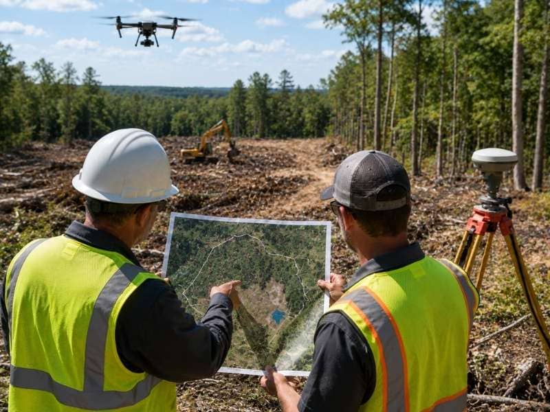
Drone surveying uses a small aircraft with a camera or laser scanner to map a piece of land from above. Before crews clear trees or brush, that view from the sky shows the whole property at once, something you just can’t get on foot. A clear picture up front means a safer, smarter clearing plan and fewer nasty surprises once the chainsaws start.
How Drone Surveying Helps Before Land Clearing
Walking a big, brushy property tells you only so much. You can see what’s right in front of you, but the shape of the whole site stays hidden behind the trees. A drone flies over the land and captures hundreds of overlapping photos, which software stitches into one detailed map. All of a sudden you can see the entire property laid out in front of you.
That full view changes how a crew plans a clearing job. You can spot where the thickest woods sit, where the ground turns rough and where a machine can move safely. Planning all of that before anyone cuts a tree saves time and keeps the work from turning into guesswork. It’s the difference between a plan built on facts and one built on hope.
Finding Slopes and Low Areas with Drone Surveying
A drone doesn’t just take flat pictures. Paired with the right tools, it builds an elevation map that shows every hill, dip and slope across the land. When the drone uses precise GPS or a few marked control points on the ground, that map can come within a couple of inches of the real measurements. That level of detail tells you exactly how the land rises and falls.
For a clearing project, that terrain data matters a lot. Steep slopes are harder and riskier to clear, so a crew can plan for them instead of getting caught off guard. Low spots warn you where water will collect and where the ground might stay soft and muddy. Knowing all of this ahead of time helps a crew stage equipment where it won’t get stuck or roll on a grade that’s too steep.
Spotting Trees and Obstacles with Drone Surveying
From the air, a drone reads the land like an open book. The map shows where the woods grow thick, where the trees thin out and where big rocks or old structures sit. A crew can measure roughly how many trees fill an area and plan the right equipment for the job. That beats rolling up on day one and discovering a boulder field nobody expected.
Some obstacles hide better than others. A drone with a laser scanner, called LiDAR, sends pulses down through the gaps in the leaves to map the ground beneath the trees. That can reveal ditches, stumps or rock ledges buried under thick brush. Finding those hazards early keeps a crew from breaking a machine or getting hurt once the clearing begins.
Why Drone Surveying Works Well on Wooded Land
Big, wooded lots are exactly where drones earn their keep. A ground crew might spend days pushing through brush and briars to cover land a drone can map in a single flight. That speed alone can turn a week of fieldwork into an afternoon. On rough or remote property, it also keeps people out of harm’s way.
Dense woods used to be a real problem for aerial mapping, but a laser scanner handles them well. Its pulses slip through the small gaps between leaves, so it can map the bare ground even on land where trees cover up to roughly ninety percent of the ground. That makes it a strong fit for the thick, hard-to-reach parcels where clearing plans matter most. A regular camera struggles to see the ground through that much cover, which is why the laser option shines on heavy woods.
How Drone Surveying Works with Ground Surveys
A drone is a great tool, but it doesn’t replace a licensed land surveyor. Think of the drone as the big-picture view and the ground surveyor as the one who nails down the exact, legal details. For a clearing plan, the aerial map is often all you need. For anything tied to property lines or a legal boundary, you still want a licensed surveyor on the ground.
The two actually work best as a team. A surveyor often places a few marked points on the ground and measures them with precise GPS, which locks the drone’s map onto real-world coordinates. The drone then covers the wide-open acres fast, while the surveyor handles the fine points that need a trained eye and a legal stamp. Used together, they give you both speed and certainty.
Frequently Asked Questions
What is drone surveying?
Drone surveying means flying a small aircraft over a property to collect photos or laser data from the air. Software turns that data into detailed maps, elevation models and 3D views of the land. It gives you a fast, full picture of a site without walking every foot of it.
How accurate is drone surveying?
Very accurate when it’s done right. With precise GPS or marked ground points to guide it, a drone map can come within a couple of inches of the real measurements. Cheaper setups without those controls are less exact, so the method matters.
Can drone surveying be used on wooded land?
Yes, and a laser scanner makes it work even on heavy woods. The laser pulses slip through gaps in the leaves to map the ground beneath the trees, on land where trees cover up to roughly ninety percent of the ground. A plain camera has a harder time seeing the ground through thick cover.
Is drone surveying faster than traditional surveying?
Usually much faster, especially on big or rough properties. A drone can map in one flight what might take a ground crew days to cover on foot. That speed saves money and keeps people off dangerous terrain.
Do I still need a licensed land survey after drone surveying?
For a clearing plan, the drone map is often enough on its own. But anything involving property lines, boundaries or a legal record still needs a licensed land surveyor. The drone shows the big picture, while the surveyor provides the exact, legal detail.
