
LiDAR Mapping for Large Acreage Development Planning
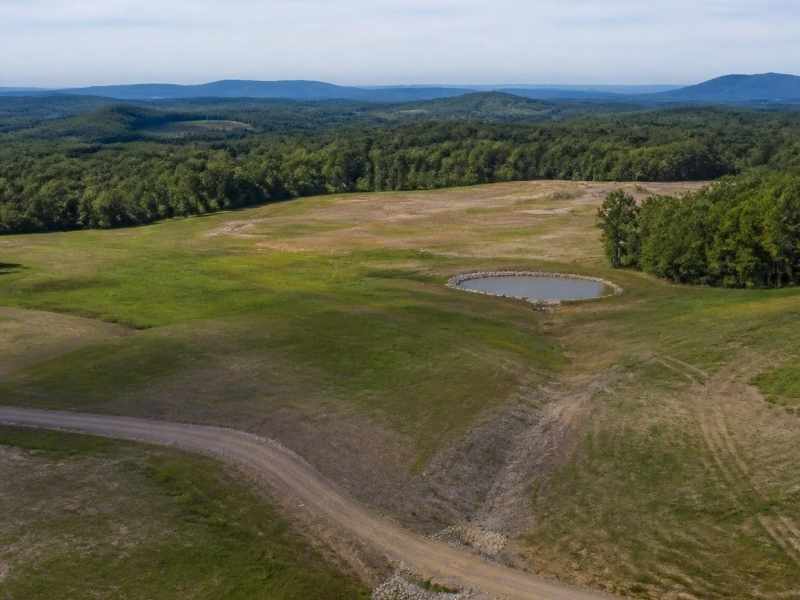
Big land looks simple from the road. The real story sits in the dirt. A wide tract can hide slopes, wet spots, old ditches, and grade changes that only show up once work begins. LiDAR mapping helps you see those details before you commit to a plan that won’t fit the land.
LiDAR mapping uses laser pulses to measure the ground with tight accuracy. A sensor sends out thousands of pulses each second, and those pulses bounce back to build a detailed model of the surface. The result is a clear picture of terrain, elevation, and features across the whole site. On hundreds of acres, that picture is hard to get any other way.
The main point comes early. Guessing about terrain on large acreage costs more than measuring it. Good survey data at the start leads to smarter roads, better drainage, and fewer change orders later.
Building a Reliable Base Map for Large Development Sites
Every development plan starts with a base map. It shows where things are and how the land sits. On a small lot, a crew can gather that data on foot in a day. On a large tract, walking every acre takes weeks and still misses spots.
LiDAR mapping covers wide ground fast. A sensor on a drone or plane scans the full site and returns millions of measured points. Those points form what surveyors call a point cloud, which is a dense 3D model of the surface. From that model, your team builds contours, spot elevations, and a base map you can trust.
A strong base map keeps everyone working from the same facts. Engineers, planners, and contractors all pull from one source. That cuts down on confusion when the design gets detailed. It also gives you a record to check against as the project moves forward.
Capturing Terrain Changes Across Expansive Properties
Large properties rarely sit flat. One corner might rise while another dips toward a creek. Small slope changes across many acres add up, and they shape where you can build. Missing them early leads to redesigns that eat time and budget.
LiDAR mapping catches these changes at fine detail. It measures elevation across the whole site, not just a few points. You see ridges, low spots, old fill, and steep grades laid out clearly. That view helps you place buildings where the ground already supports them.
The data also shows ground under trees and brush. LiDAR pulses can reach through gaps in the canopy and hit bare earth. Surveyors filter out the plants and keep the ground points. On wooded or overgrown tracts, that ability reveals terrain you could not have seen otherwise.
Planning Roads, Pads, and Utility Corridors With Better Site Data
Roads and pads have to match the land. A road that fights the grade needs more cut and fill, which raises cost. A building pad on a bad slope may need extra dirt work or a redesign. Accurate terrain data lets you route and place these features the smart way.
LiDAR mapping supports that planning from the first sketch. You can test different road paths against real elevations before you pick one. You can size pads and grading plans with numbers instead of guesses. When the layout depends on tight grades, that accuracy protects your schedule.
Utility corridors gain from the same data. Water, sewer, power, and stormwater lines all follow the land’s slope and elevation. Clear terrain data helps you plan those routes with fewer conflicts. Fixing a corridor on paper is far cheaper than fixing it in the field.
Spotting Drainage Features and Elevation Constraints Early
Water goes where the land tells it to go. On a big acreage, that path is not always obvious from a walk-through. LiDAR mapping shows how water moves across the site by mapping every slope and low point. That view helps you plan drainage before it becomes a problem.
You can spot natural channels, ponding areas, and ridges that split flow. You can also flag low ground that may sit in or near a floodplain. Flood zones can vary by parcel and by map updates, so confirm the current designation with the right agency and your engineer. Early data lets you design detention, grading, and outfalls that work with the site.
Elevation limits matter too. Some sites have grade breaks that push a road or pad in one direction only. Knowing those limits up front keeps your plan realistic. It also gives reviewers and lenders confidence that the design fits the ground.
Turning LiDAR Data Into Smarter Development Decisions
Raw data alone does not build a project. The value shows up when your team reads it and acts on it. A skilled surveyor turns the point cloud into contours, cross sections, and volume estimates you can use. Those products feed straight into design and cost planning.
Good data sharpens the choices that drive a budget. You can compare grading options and see which one moves less dirt. You can check whether a layout triggers extra retaining walls or drainage work. Each answer helps you decide with facts instead of hope.
LiDAR mapping also pairs well with other survey work. It supports topographic surveys, boundary checks, and construction staking as the project grows. Survey needs can shift by property type, lender, and municipality, so confirm what your project requires early. Starting with solid data keeps the whole plan on firmer ground.
Frequently Asked Questions
How accurate is LiDAR mapping for development planning?
LiDAR can measure elevation and ground features to a high level of accuracy. The exact numbers depend on the sensor, the flight height, and the ground cover. A surveyor checks the data against control points to confirm the quality. That step keeps the results reliable for planning and design.
Can LiDAR see the ground under trees?
Yes, LiDAR pulses can pass through gaps in leaves and reach bare earth. Surveyors then filter out the plant points and keep the ground points. This gives a clean terrain model even on wooded land. It works well on tracts that are hard to walk.
Is LiDAR mapping worth it for large acreage?
On large acreage, LiDAR often saves more than it costs. It covers wide ground fast and catches terrain issues before design. That early view helps you avoid redesigns, extra dirt work, and delays. The bigger and more complex the site, the more the data pays off.
